
About us
About American Engineering
A California-certified Disabled Veteran Business Enterprise (DVBE) and a Service-Disabled Veteran-Owned Small Business (SDVOSB).
Who is American Engineering?
American Engineering is a California land surveying and civil engineering firm whose team includes licensed professional engineers and a licensed land surveyor, who sign the surveys, maps, and plans the firm prepares.
Our work covers four areas: land surveying, land development and mapping, civil engineering and site design, and stormwater and erosion control. Because surveying and design sit in one firm, a project can move from the first boundary and topographic survey to plans, permits, and construction staking on the same survey control.
We work for property owners, developers, builders, and design teams, as well as public agencies and prime contractors. We are a California-certified DVBE and an SDVOSB.
To see how that work comes together on real projects, see our Past Work case studies. Our News Room explains the California rules behind surveys, maps, site design, and stormwater permits in plain language.
Services
Our services
Four groups of services, from the first survey of a property to the stormwater plan that keeps its construction site in compliance.
-
Land Surveying
Topographic, boundary, and ALTA/NSPS land title surveys, records of survey and corner records, legal descriptions and easements, construction staking, and FEMA elevation certificates.
-
Land Development & Mapping
Parcel and subdivision maps, lot line adjustments and mergers, feasibility studies before you buy or build, and planning and entitlement support.
-
Civil Engineering & Site Design
Site layouts, improvement plans for streets, storm drains, and sewer extensions, grading plans, septic system design, and metal building foundation design.
-
Stormwater & Erosion Control
Stormwater calculations, erosion and sediment control plans, Stormwater Pollution Prevention Plans (SWPPPs), and SWPPP inspections for construction sites.
Process
How we work
The same four steps apply whether you need one survey or a full set of site plans.
Define the scope
We start with what you plan to build and what your city, county, title company, or lender requires, then put the scope, deliverables, and assumptions in a written proposal.
Research the records
Recorded maps, deeds, title reports, benchmarks, and agency standards are gathered before fieldwork, so the survey and the design both start from the public record.
Measure and design
Field crews collect the survey data, and engineers design grading, drainage, utilities, and stormwater controls from that same survey control.
Review, seal, and deliver
The licensed professional in responsible charge reviews the work before it is signed and sealed. We answer agency plan-check comments and can stake the approved design in the field.
Who we work with
Most projects involve several of these people. Each needs something different from a survey or a set of plans.
-
Property owners
Property-line questions, lot line adjustments, septic system design, and elevation certificates for flood zones.
-
Developers and builders
Topographic surveys, subdivision maps, grading and improvement plans, construction staking, and SWPPPs.
-
Architects and design teams
Base maps to design from, site layouts for permit submittal, and foundation design for metal buildings.
-
Title officers, escrow, and lenders
ALTA/NSPS land title surveys and legal descriptions for sales, refinancing, and easements.
-
Public agencies and prime contractors
Topographic and boundary surveys, construction staking, improvement plans, and SWPPPs for public works projects. Because we are a California-certified DVBE, state agencies and prime contractors can count our work toward DVBE participation goals when we perform a commercially useful function on a distinct scope of work. See how California's 3% DVBE goal works.
Our people
Meet the team
The engineers and surveyors behind our surveys, maps, and plans.
-

Chris Duffy, PE
Professional Engineer
Chris grew up in a small Northern California farming town, where he learned his work ethic from his parents on a hunting club and local farms. After high school, he served as an aircraft mechanic in the U.S. Air Force from 1999 to 2004, earning an honorable discharge. After the military, he managed a hunting club and then earned a bachelor's degree in civil engineering. He is a licensed professional engineer in California with expertise in stormwater management, project management, construction plan review, and construction inspection.
-
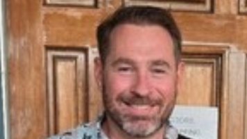
Whyatt Nixon, PE
Professional Engineer
Whyatt Nixon, from Paradise, California, developed a strong work ethic from his mother, a nurse, and his father, a contractor. He earned a civil engineering degree from CSU Chico, where he met his wife. After working in the Bay Area, he returned to be near family and advance his career in land surveying and development, becoming a licensed civil engineer. Whyatt works on projects such as subdivisions and storm drain systems, contributing to his community's growth.
-

Nicholas Quedens, L.S.
Lead Land Surveyor
Nick Quedens is a licensed land surveyor with nine years of experience in his field. Originally from Paradise, California, he graduated from California State University, Chico, where he found his passion for civil engineering. Outside of work, Nick enjoys working in his yard, traveling with his wife and daughter, and sharing a good laugh. A sports enthusiast, he loves both watching and playing games.


Last updated